The Mountain Root Paradox: Why the Himalayas Float Like Icebergs
Stand at the base of Mount Everest and look up nearly nine kilometers into the troposphere. The sheer mass of stone is staggering. Millions of tons of solid granite reach toward the jet stream. Common sense suggests that an object this colossal should sink into the Earth like a bowling ball dropped into mud.
Yet the opposite is true. For over a century, geologists noticed a baffling gravitational puzzle: when surveying the foothills of northern India, plumb lines (lead weights on string) were deflected toward the towering Himalayas far less than their immense visible mass predicted. Why did the mountains exert such a weak sideways gravitational pull?
The answer revealed one of the most profound physical laws in planetary science: mountain ranges have deep subterranean roots. Just as 90 percent of an iceberg hides beneath ocean water to support the tip above the surface, mountains float atop deep, buoyant crustal roots plunging up to 70 kilometers into Earth's ductile upper mantle. This gravitational balance between downward weight and upward buoyancy is called isostasy.
In middle school Earth Science curricula aligned with NGSS MS-ESS2-1 and MS-ESS2-2, students must discover that Earth's crust is not cemented into a rigid sphere. Instead, our planet's surface is a dynamic flotilla of rock slabs floating on a hot, semi-fluid mantle. Without isostasy, Earth would have no dry continents, no deep ocean basins, and no stable coastlines.
Just like wooden blocks of pine and oak floating in a bucket of water, tectonic plates sink into the asthenosphere until the mass of displaced mantle equals the total mass of the crustal block.
Granite vs. Basalt: The Density Duel That Shapes Our Planet
Why does Earth have distinct dry continents and water-filled oceans rather than a uniform muddy swamp? The secret lies in a subtle density difference between two igneous rocks: granite and basalt.
Continental crust is primarily composed of granitic rocks rich in silica and aluminum (felsic composition). Granite has an average density of approximately 2.7 grams per cubic centimeter. In contrast, oceanic crust is forged at mid-ocean spreading rifts from dark, iron- and magnesium-rich basalt (mafic composition), with a higher density of approximately 3.0 grams per cubic centimeter.
Beneath both crustal types lies the asthenosphere, the ductile upper layer of Earth's mantle, with an even higher density of roughly 3.3 grams per cubic centimeter. Because continental granite is significantly lighter and thicker (30 to 50 km thick) than oceanic basalt (5 to 10 km thick), it floats high like an empty wooden cargo ship. Dense, thin oceanic rock sinks low, carving the natural planetary depressions that hold our oceans.
| Geological Layer | Primary Rock Composition | Average Density (g/cm³) | Typical Thickness (km) | Isostatic Equilibrium Role |
|---|---|---|---|---|
| LIGHT & BUOYANTContinental Crust | Granite, rhyolite (felsic minerals, silica-rich) | 2.7 g/cm³ | 30 to 50 km (up to 70 km under mountains) | Floats high above sea level; forms dry landmasses and mountain belts |
| DENSE & COMPACTOceanic Crust | Basalt, gabbro (mafic minerals, iron & magnesium) | 3.0 g/cm³ | 5 to 10 km | Sinks low into mantle depressions; forms ocean basins that cradle seawater |
| DUCTILE BASEUpper Mantle (Asthenosphere) | Peridotite (ultramafic ductile silicate rock) | 3.3 g/cm³ | 100 to 200 km zone | Dense, semi-solid fluid foundation that provides upward buoyant restoring force |
The Mechanics of Level 01: Balancing Crustal Buoyancy in Real-Time 3D
In Level 01 of the Praxos Volcano Island simulation laboratory (The Floating Crust), students step into the role of planetary geophysicists. Rather than memorizing static diagrams in a textbook, the student manipulates an interactive 3D orthographic cutaway diorama showing two tectonic blocks floating atop a glowing amber mantle.
A crystal-blue sea level line bisects the diorama. The oceanic plate on the right is locked at standard basaltic metrics (density 3.0 g/cm³, thickness 8 km). On the left, the student controls two live sliders:
1. Continental Crust Density: Variable from 2.2 to 3.2 g/cm³ (defaulting to an unstable 3.1 g/cm³).
2. Continental Crust Thickness: Variable from 10 to 60 km (defaulting to a thin 15 km).
As the simulation ticks forward across 30 epochs, the Three.js physics engine calculates real-time hydrostatic equilibrium using Archimedes' Principle. If continental density is set too high or thickness too thin, the land sinks below the blue waterline, flooding the plains. If calibrated correctly, continents stand proud at +1.5 km while ocean trenches settle safely at -3.0 km.
Before unlocking the Play button, every student must select and test one of three structured hypotheses:
Hypothesis A: The Golden Equilibrium (Balanced Buoyancy)
Calibrate Continental Density to 2.7 g/cm³ and Continental Thickness to 35 km. Because the lighter rock displaces sufficient mantle volume, the continental surface settles stably at +1.5 km above sea level while oceanic crust remains at -3.0 km depth.
Hypothesis B: The Dense Continent Sink (Flooded Plains)
Increase Continental Density to 3.1 g/cm³ while leaving thickness at 35 km. The heavier rock loses buoyant lift, plunging below the water line at Epoch 8. Water droplet alerts sound as the continent drowns.
Hypothesis C: The Thin Crust Submergence
Keep Continental Density light at 2.6 g/cm³ but reduce Thickness to 12 km. Even though the rock is light, insufficient slab thickness fails to displace enough mantle mass to rise above the ocean level line.
Start Level 1 instantly in your browser with zero registration. Experience how rock density and thickness create continents and ocean basins in real-time 3D.
Launch Free Level 1 Volcano SimulationBalance Earth's Floating Crust & Ocean Basins in 3D
Adjust Continental Crust Density and Thickness in our real-time cutaway diorama. Reach isostatic equilibrium so land rises above sea level and deep ocean basins form. Zero sign-up, instant browser play.
The Dual-Format Advantage: Calculating Archimedean Displacement on Paper First
Why does Praxos require students to use a printed field logbook alongside their digital simulation? Because when children only touch digital screens, they tend to manipulate sliders haphazardly until a victory chime sounds, without absorbing the underlying physics.
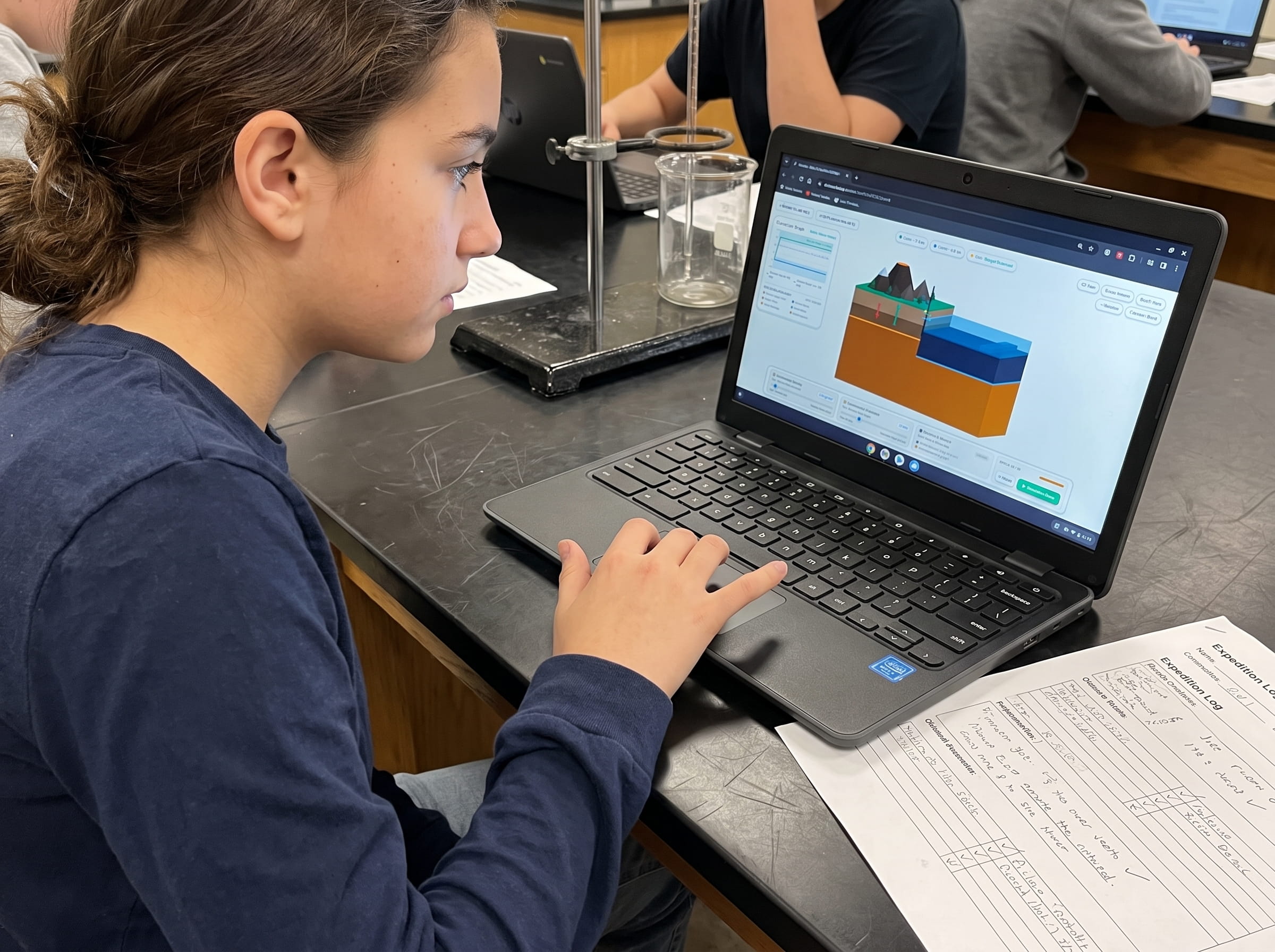
In our dual-format Earth Science curriculum, the student opens their physical Volcano Island Expedition Science Journal before touching the keyboard. They write down their pre-run prediction, calculate expected buoyant displacement ratios using simple ratios, and mark their predicted waterline on a cross-section diagram.
During the 30-epoch simulation run, the student logs continental elevation and oceanic floor depth at Epoch 10, Epoch 20, and Epoch 30. Finally, they construct a dual-axis coordinate line plot and formulate a Claim-Evidence-Reasoning (CER) response explaining why continental granite floats higher than oceanic basalt. This tactile routine builds rigorous scientific habits that transfer directly into standardized assessments.
Prompt for students: What caused your continent to sink on Trial 1? Using Archimedes' Principle, explain why a block of granitic rock (2.7 g/cm³) floats higher in the mantle (3.3 g/cm³) than a block of oceanic basalt (3.0 g/cm³).
Frequently Asked Questions About Crustal Isostasy and Level 01
Common questions from homeschool educators, classroom teachers, and curious students exploring isostatic equilibrium.
What is post-glacial isostatic rebound and does it prove isostasy is real?
Why does Level 1 focus on density before introducing volcanoes or earthquakes?
What is the exact win condition for Volcano Island Level 1?
Can students play Volcano Island Level 1 on school Chromebooks or tablets?
Related Earth Science Units & Simulation Lab Resources
Continue your middle school Earth and Space science exploration with these curriculum-aligned resources:
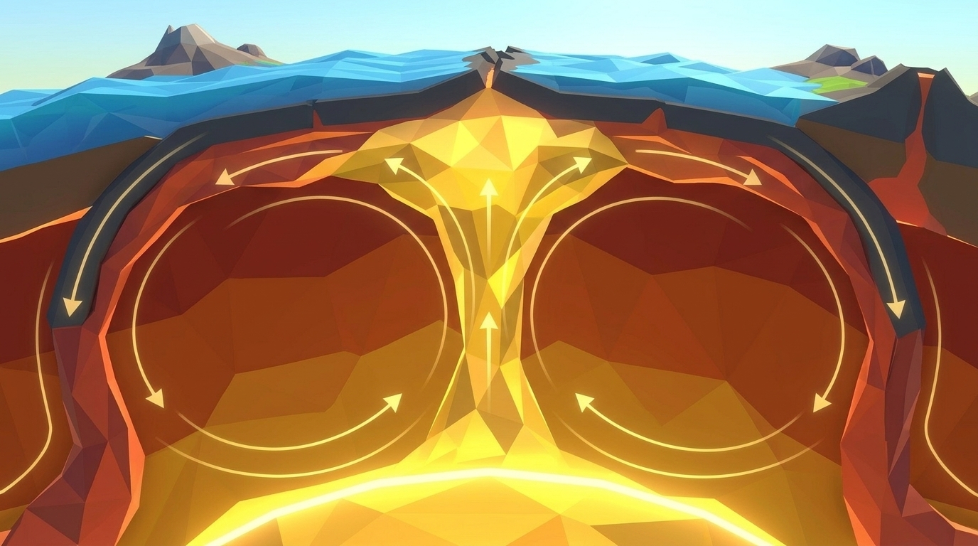
Explore mantle heat circulation in our mantle convection tectonics simulation guide.
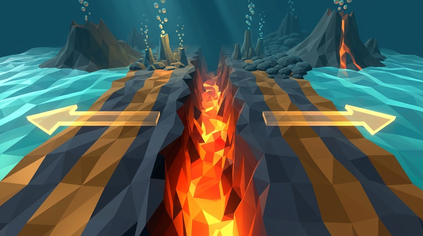
Discover mid-ocean rifts in our seafloor spreading divergent boundary simulation lab.
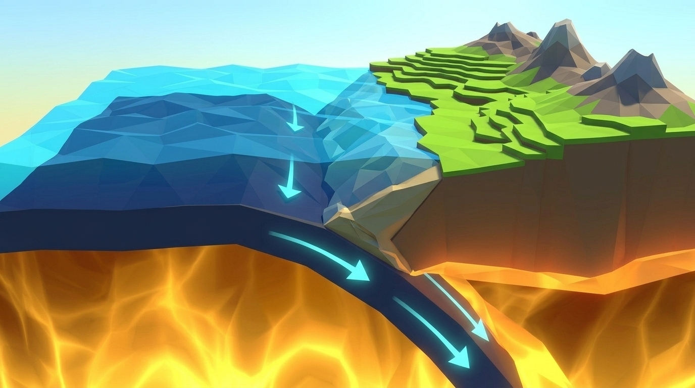
Investigate subduction abysses in our subduction zones deep trench simulation article.
Review complete homeschool science options in our earth science homeschool curriculum guide.
Set up student accounts with zero student logins on our educator dashboard.
24 pages of printable isostatic buoyancy calculation tables, plate boundary cross-section templates, and seismogram triangulation exercises designed for grades 4 to 8.
DOWNLOAD EXPEDITION LOGBOOK (PDF)Level 1 Geologist Field Log & Isostasy Calculator (PDF)
A printable 24-page Volcano Island Expedition Science Journal featuring structured prediction hypotheses, crustal density calculation tables, and elevation graphing charts.