The Mariana Abyss: The Deepest Canyon on Planet Earth
Plunge nearly eleven kilometers beneath the western Pacific Ocean into Challenger Deep. At the bottom of the Mariana Trench, the water pressure exceeds 1,000 atmospheres: equivalent to an elephant standing on your thumb. If Mount Everest were severed at sea level and placed into the chasm, its snowy summit would still sit more than two kilometers underwater.
Common sense suggests that the deepest point on Earth should lie in the dead center of our widest ocean basin. Yet oceanic trenches defy this intuition: they consistently hug the margins of continents and volcanic island arcs. Why do the planet's deepest abysses sit right along collision boundaries?
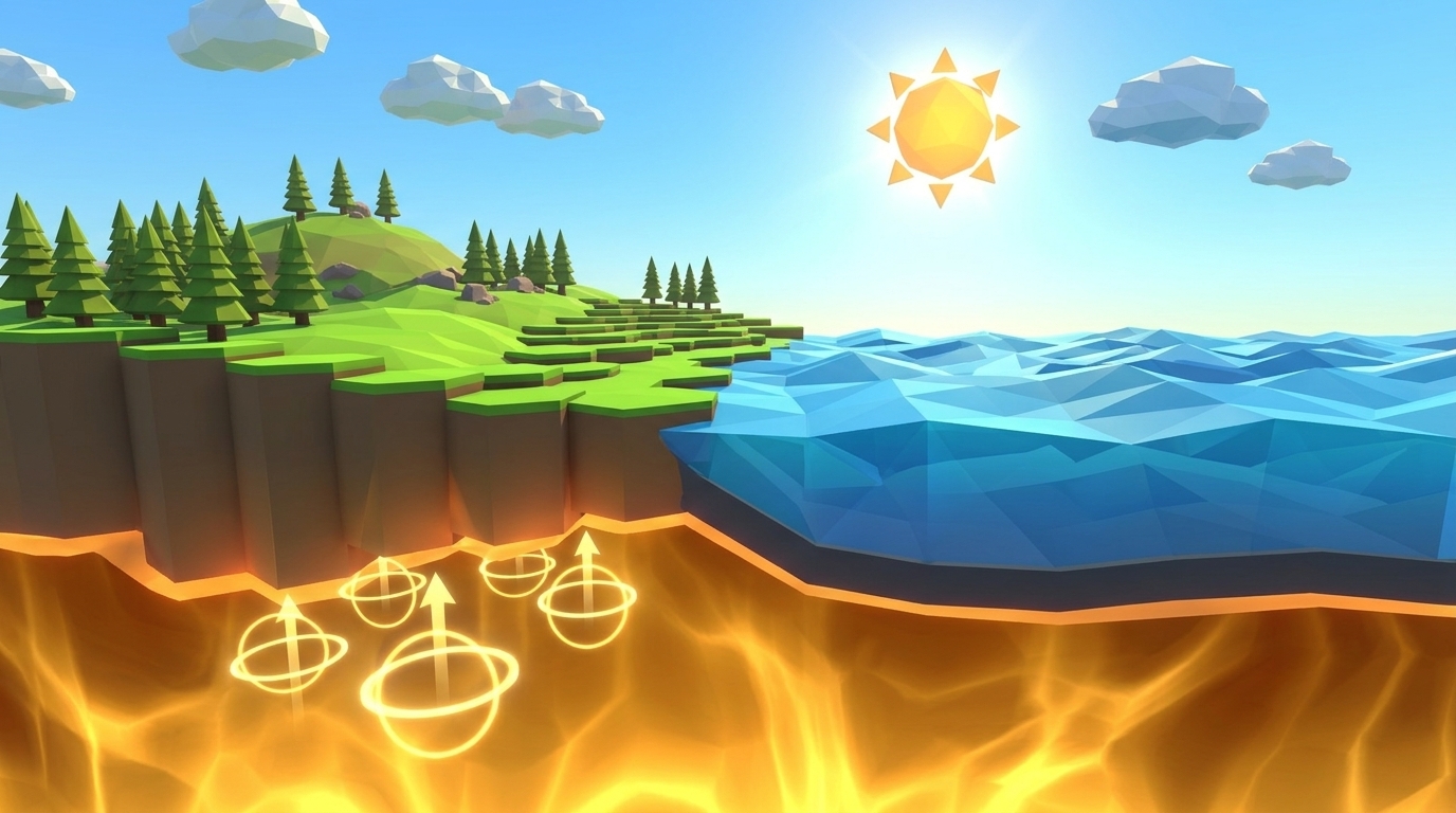
The answer lies in the relentless physics of crustal aging and density. As oceanic lithosphere travels away from divergent mid-ocean ridges (explored in Level 3), it cools from scorching volcanic temperatures down to near-freezing seabed temperatures. Over 150 million years, seawater hydrates the crust, heavy pelagic sediment accumulates, and the underlying mantle lithosphere thickens. By the time it arrives at a continental margin, oceanic rock is significantly colder and denser than the hot asthenosphere beneath (3.0 vs 3.3 g/cm³).
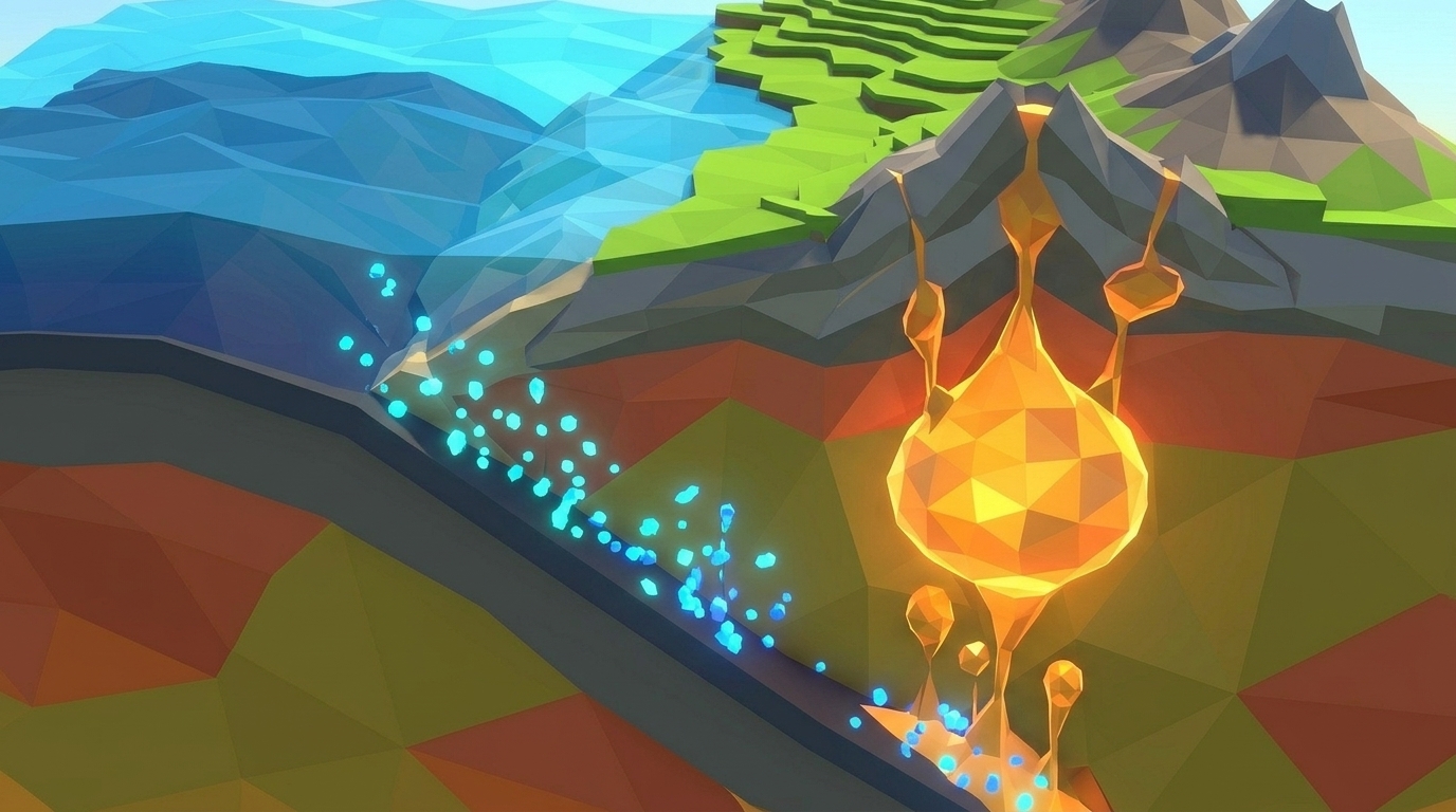
When this dense oceanic slab collides with a thick, buoyant granitic continent (density 2.7 g/cm³), there is no shoving contest: the buoyant continent stands tall while the heavy oceanic slab flexes sharply downward, diving into the subterranean mantle and carving a colossal V-shaped trench at the bending hinge.
Tectonic plates never crash into a neutral stalemate. The denser oceanic plate always plunges beneath the buoyant continent, carving an oceanic trench at the collision hinge.
The Anatomy of a Subduction Zone: Trenches, Prisms, and Volcanic Arcs
A subduction zone is not merely a crack in the ground; it is a complex, multi-tiered geological recycling factory spanning hundreds of kilometers:
1. The Trench Axis: The sharp topographic V-notch marking the hinge line where the oceanic plate flexes and begins its steep descent into the mantle.
2. The Accretionary Wedge (Prism): As the oceanic plate descends, soft marine clays, biogenic ooze, and ancient seamounts are scraped off against the leading edge of the overriding continental plate like snow on a plow, crumpling into chaotic coastal mountain ranges.
3. The Forearc Basin: The relatively stable structural depression situated between the accretionary wedge and the active volcanic mountain front.
4. The Volcanic Arc: At approximately 80 to 120 kilometers depth, intense heat and pressure cook water out of the descending slab, triggering partial melting in the overlying mantle wedge (setting up Level 5: First Magma Chamber).
5. The Wadati-Benioff Zone: A dipping plane of earthquake epicenters that traces the descending slab deep into the interior, generating brittle fracture earthquakes down to depths of 700 kilometers.
| Oceanic Trench | Tectonic Setting | Maximum Depth (m) | Slab Dip Angle | Geological Hazard Signature |
|---|---|---|---|---|
| DEEPEST ABYSSMariana Trench (Western Pacific) | Old Pacific Plate under Philippine Sea Plate | 10,994 meters (Challenger Deep) | Steep (60° to 90° near vertical) | Deep oceanic abyss; minimal megathrust locking; slab rollback |
| CONTINENTAL ARCPeru-Chile Trench (South America) | Nazca Oceanic Plate under South American Continent | 8,065 meters (Atacama Deep) | Moderate (25° to 35° angle) | Massive megathrust earthquakes (1960 Valdivia M9.5) & towering Andes volcanic arc |
| LOCKED MEGAGRIDCascadia Subduction Zone (North America) | Juan de Fuca Plate under North American Plate | Shallow filled trench (~3,000 m) | Shallow (12° to 18° underplating) | Locked megathrust fault overdue for a catastrophic magnitude 9.0 earthquake |
The Mechanics of Level 04: Calibrating Subduction in Real-Time 3D
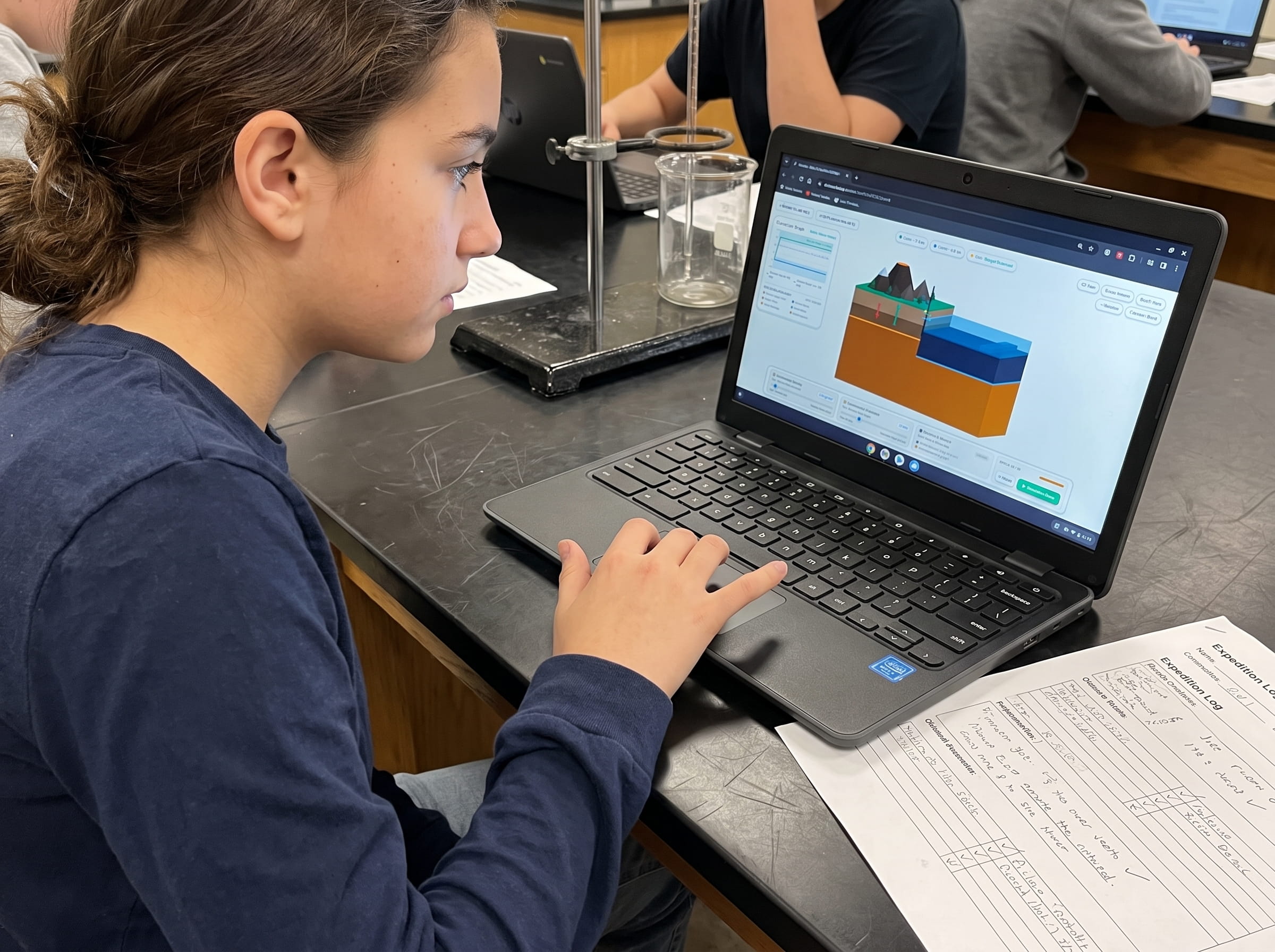
In Level 04 of the Praxos Volcano Island simulation laboratory (The Deep Trench), students take control of a converging tectonic plate margin. An orthographic Three.js cutaway diorama displays an oceanic plate descending into a glowing amber mantle beneath an elevated continental landmass.
To sustain smooth subduction across 50 simulation epochs, students manipulate two critical geophysical controls:
1. Slab Dip Angle: Variable from 15° to 75° (defaulting to a flat, dangerous 20°).
2. Slab Sinking Velocity: Variable from 1.0 to 10.0 cm/year (defaulting to a sluggish 1.5 cm/yr).
A synchronized 2D coordinate graph tracks Trench Depth (km below sea level, target: -8.0 to -11.0 km) plotted against Interplate Frictional Stress (MPa). At Epoch 25, an accretionary wedge stress checkpoint verifies plate convergence stability.
If the slab dip angle is too shallow (under 25°), the oceanic plate scrapes directly against the underside of the continent, causing frictional stress to exceed 120 MPa and triggering a catastrophic continental jam failure. If the dip angle is too steep (over 65°), the dense slab tears away from the surface plate, collapsing the trench. To win, students must calibrate a smooth, stable subduction angle between 40° and 55° with velocity between 4.5 and 6.0 cm/year.
Before launching the simulation run, students formulate and test one of three structured inquiry hypotheses:
Hypothesis A: The Balanced Subduction Roll (Dynamic Equilibrium)
Calibrate Slab Dip Angle to 48° and Sinking Velocity to 5.2 cm/year. The oceanic slab bends smoothly at the trench hinge, maintaining a stable 9.5 km trench depth with frictional stress low at 45 MPa.
Hypothesis B: The Shallow Underplating Jam (Frictional Lockup)
Set Slab Dip Angle to 18° with Velocity at 6.0 cm/year. The shallow slab scrapes directly under the continental crust, generating immense friction above 135 MPa that halts subduction and crumples the continent.
Hypothesis C: The Steep Slab Tear & Rollback (Structural Rupture)
Increase Slab Dip Angle to 72° while setting Velocity to 8.5 cm/year. The gravitational pull becomes too vertical, causing the descending slab to snap and tear away from the surface lithosphere.
Take command of Earth's ultimate crustal recycling zone in your browser. Balance slab dip angle and sinking velocity in real-time 3D to plunge oceanic rock safely into the mantle.
Launch Free Level 1 Volcano SimulationNavigate Oceanic Subduction & Deep Trenches in 3D
Calibrate Slab Dip Angle and Sinking Velocity in our real-time cutaway diorama. Plunge dense oceanic crust into the mantle without triggering catastrophic continental jamming or slab tear. Zero sign-up, instant browser play.
Slab Pull: The Secret Gravity Engine Powering 90% of Continental Drift
For decades, early geology textbooks claimed that tectonic plates were pushed across the globe by fresh magma welling up at mid-ocean ridges. Modern geophysics has proven that this explanation is largely backwards.
While ridge push contributes approximately 5 to 10 percent of plate velocity, the true engine of plate tectonics is slab pull. As oceanic lithosphere cools, its mineral structure undergoes intense metamorphic compaction: basalt and gabbro transform into eclogite, a high-pressure rock rich in garnet and pyroxene that is significantly denser than the surrounding mantle.
This dense mineral phase change turns the descending slab into a colossal gravitational anchor. Just as a heavy iron chain sliding off the side of a boat accelerates as more links fall into the water, the weight of the sinking slab pulls the entire trailing oceanic plate across the globe behind it. Mid-ocean ridges do not push plates; they are passive fractures pulled apart because subduction trenches on the other side of the planet are devouring the seafloor.
Tectonic plates are not pushed from behind by mid-ocean ridges; they are dragged across the globe by the gravitational weight of cold, dense slabs plunging into subduction zones.
The Dual-Format Advantage: Plotting Benioff Zone Earthquakes on Paper
Why does Praxos require students to complete printed journal entries before touching the simulation controls? Because hands-on kinesthetic graphing builds spatial reasoning that cannot be replicated by tapping a screen.
In our dual-format curriculum, students open their printable Volcano Island Expedition Science Journal to Mission 04. Using actual seismic data from the Kuril-Kamchatka trench, students plot earthquake focal depths on a cross-section grid: shallow tremors near the trench (10 to 30 km deep), intermediate earthquakes under the forearc (70 to 200 km deep), and deep-focus earthquakes beneath the volcanic arc (300 to 600 km deep).
Connecting the plotted earthquake points reveals a clear inclined plane slicing directly into the mantle: the Wadati-Benioff zone. By measuring the angle of this earthquake line with a physical protractor, students calculate the real-world dip angle of the subducting plate. They then formulate a Claim-Evidence-Reasoning (CER) justification explaining why deep earthquakes can only occur in cold, brittle subducting slabs and never in the warm ductile mantle surrounding them.
Prompt for students: Using your plotted earthquake focal points, draw the outline of the descending oceanic plate. Explain why earthquakes can happen 600 km deep inside a subduction zone, even though surrounding mantle rock is too hot and ductile to shatter.
Frequently Asked Questions About Subduction Zones and Level 04
Answers to common questions from middle school educators, homeschool parents, and students studying convergent plate boundaries.
What happens to the seawater carried down by the subducting plate?
Can two continental plates subduct beneath each other?
Why are the world's most dangerous earthquakes located at subduction zones?
What is the exact win condition for Volcano Island Level 4?
How does Level 4 lead directly into Level 5 (First Magma Chamber)?
Related Earth Science Units & Simulation Lab Resources
Continue your middle school Earth and Space science exploration with these curriculum-aligned resources:
Review crustal buoyancy in our crustal buoyancy isostasy simulation Level 1 guide.
Explore deep thermal circulation in our mantle convection tectonics simulation Level 2 guide.
Discover seafloor spreading in our seafloor spreading divergent boundary simulation Level 3 lab.
Review complete homeschool science options in our earth science homeschool curriculum guide.
Set up student accounts with zero student logins on our educator dashboard.
24 pages of printable isostatic buoyancy calculation tables, paleomagnetic zebra stripe rulers, and seismogram triangulation exercises designed for grades 4 to 8.
DOWNLOAD EXPEDITION LOGBOOK (PDF)Level 4 Oceanic Trench Anatomy & Slab Pull Logbook (PDF)
A printable 24-page Volcano Island Expedition Science Journal featuring structured trench cross-section templates, Benioff zone earthquake plotting grids, and slab pull force calculation tables.