Why Static 2D Cross-Sections Fail Young Scientists
For generations, middle school Earth Science education has relied on a single familiar drawing: a neat brown triangle sliced in half, showing a bright red pipe labeled "magma chamber" leading to a symmetrical smoke puff. Students memorize the labels, pass the vocabulary quiz, and completely miss how the Earth actually works.
Textbook cross-sections fail because they present a dynamic thermal engine as an inert anatomy diagram. In reality, a volcano is not a static cone with an open pipe to the center of the Earth. It is the emergent, chaotic exhaust valve of a planetary convection cycle operating across thousands of kilometers and millions of years.
When students look at flat paper diagrams, they develop three deep misconceptions that take years to unlearn. First, they assume magma sits in giant subterranean swimming pools waiting to boil over, rather than generating via subtle decompression and flux melting in solid, ductile rock. Second, they fail to grasp that magma viscosity dictates eruption violence: low-silica basalt produces gentle Hawaiian lava fountains, while sticky, high-silica rhyolite seals the vent until trapped gas shatters the entire mountain. Third, they view volcanoes as isolated geographic curiosities, completely disconnected from lithospheric plate boundaries and mantle convection.
Memorizing the parts of a volcano on paper teaches anatomy, not physics. To understand why Mount St. Helens exploded while Kilauea oozes gently, students must experiment with fluid viscosity, gas solubility, and tectonic pressure directly.
The Core Geophysics Engine: 4 Dynamic Variables in 3D
In a true interactive 3D volcano simulation, students do not memorize facts; they manipulate underlying physical principles and observe the emergent geological consequences. By adjusting independent variables within a WebGL physics diorama, cause and effect become intuitive.
The Praxos Volcano Island engine models four foundational geological variables that govern volcanic systems from the core-mantle boundary to the atmosphere.
| Geological Concept | Traditional 2D Textbook | Basic 2D Web Quiz | Praxos 3D Simulation Lab |
|---|---|---|---|
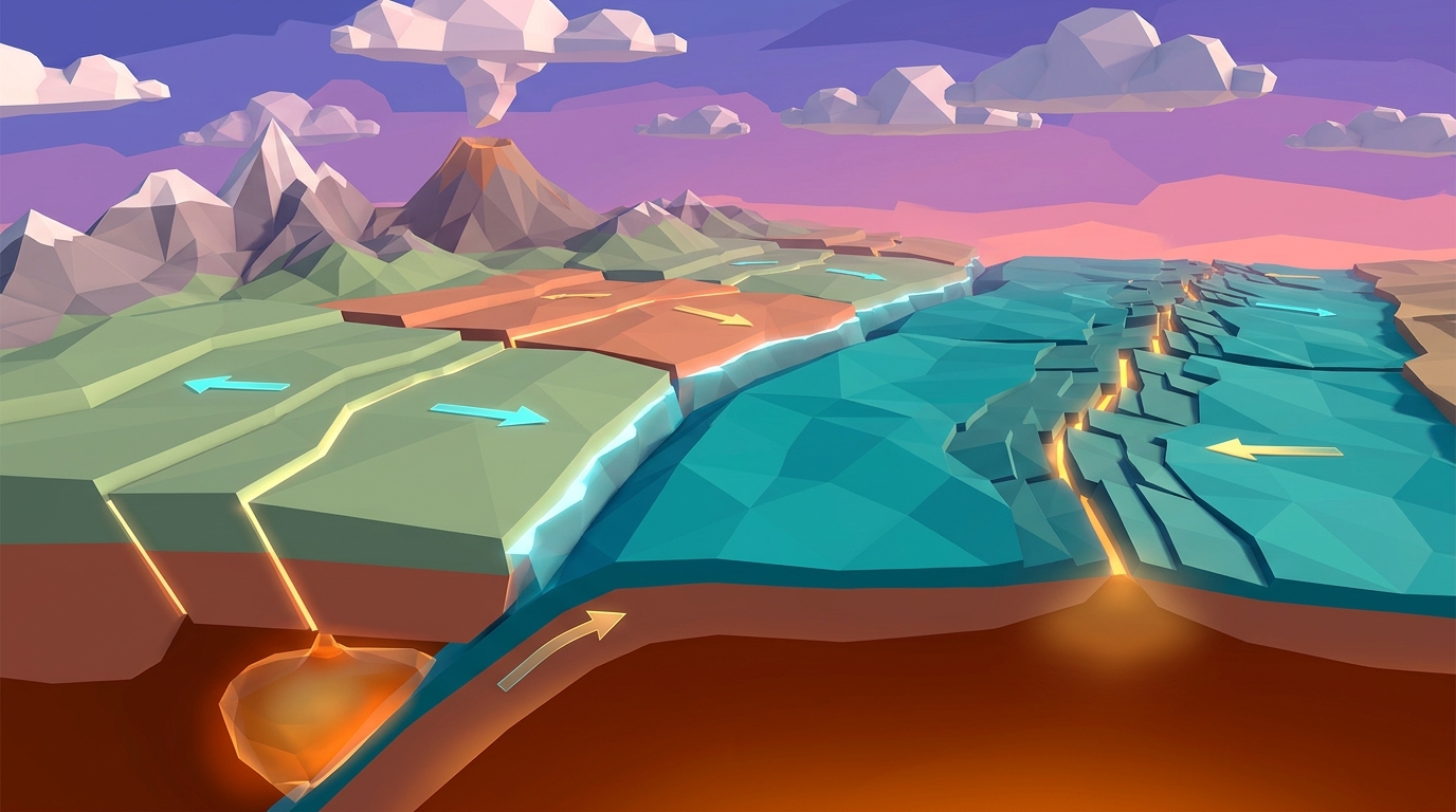
| Thermal EngineMantle Convection | Static arrows drawn inside a circle | Multiple choice definition quiz | Real-time thermal fluid loops rolling crustal conveyor belts |
| Density BalanceCrustal Isostasy | Block diagram showing floating heights | Drag-and-drop label exercise | Adjust crust density & thickness; watch continents float or sink |
| Explosive DynamicsMagma Viscosity | Text describing runny vs thick lava | Matching volcanic rock types | Slide silica from 50% to 70%; trigger effusive flows vs Plinian blasts |
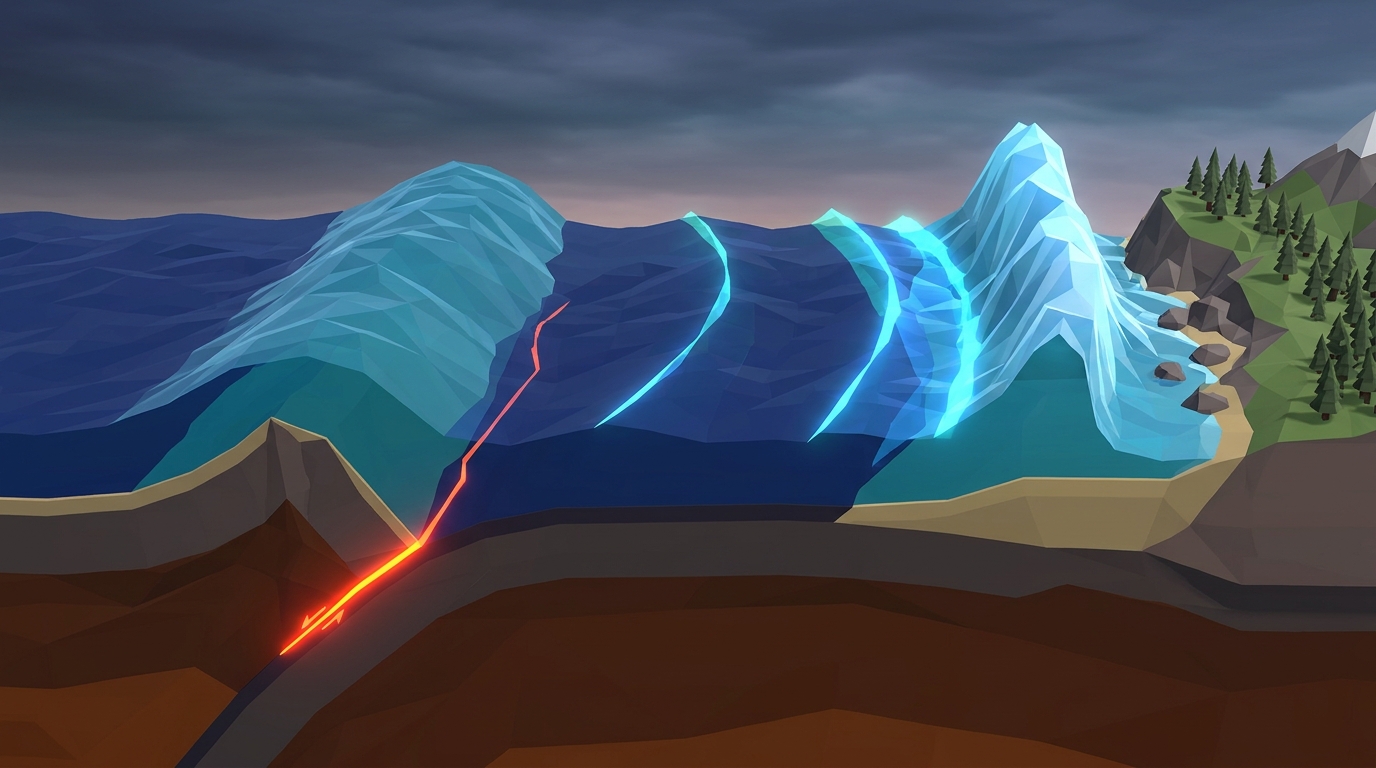
| GeohazardsSubduction & Hazards | Cross-section of oceanic plate diving | Static hazard zone map | Control slab pull, accumulate fault stress, and trigger 3D tsunamis |
Mantle Thermal Convection (The Planetary Engine)
Radioactive decay deep within Earth creates extreme thermal gradients. Hot rock becomes buoyant and ascends, while cool lithosphere descends, driving the conveyor belts that move tectonic plates at rates between 1 and 10 centimeters per year.
Crustal Buoyancy & Isostatic Balance
Continental crust (mostly granite, 2.7 g/cm³) floats high above the denser mantle like an iceberg, while oceanic crust (mostly basalt, 3.0 g/cm³) sits low, creating oceanic basins and governing where subduction must occur.
Silica Viscosity & Gas Retention
Magma with low silica content (48% to 52%) allows volcanic gases to bubble out harmlessly, creating fluid lava rivers. High silica magma (65% to 75%) polymerizes into thick, sticky chains that trap expanding water vapor until catastrophic overpressure blows the rock apart.
Fault Friction & Elastic Rebound
Tectonic plates sliding past each other do not glide smoothly. Jagged asperities lock the fault, storing enormous elastic strain energy like a drawn bow until friction fails, releasing catastrophic seismic waves and seafloor displacement.
The 4-Phase Curriculum Progression (Levels 1 to 20)
Rather than throwing students into a confusing sandbox, Volcano Island organizes complex geophysics into four progressive curriculum phases spanning 20 interactive missions. Each mission isolates a specific variable, asks for a prediction, and lets the student verify their thinking in real time.
This structured scaffolding ensures that students master foundational crustal physics before attempting to forecast supervolcanoes or design disaster mitigation sea walls.
Deep Earth & Crustal Engine (Levels 1 to 5)
Students explore isostatic buoyancy, thermal mantle convection, seafloor spreading at divergent mid-ocean ridges, oceanic subduction trenches, and continental mountain building in the Himalayas.
Magma Mechanics & Volcanic Architecture (Levels 6 to 10)
Focuses on subterranean geochemistry: flux melting in subduction slabs, basaltic Hawaiian shield volcanoes, high-silica stratovolcanoes like Mount St. Helens, caldera collapse, and stationary mantle hotspots.
Seismic Stress, Ruptures & Tsunamis (Levels 11 to 15)
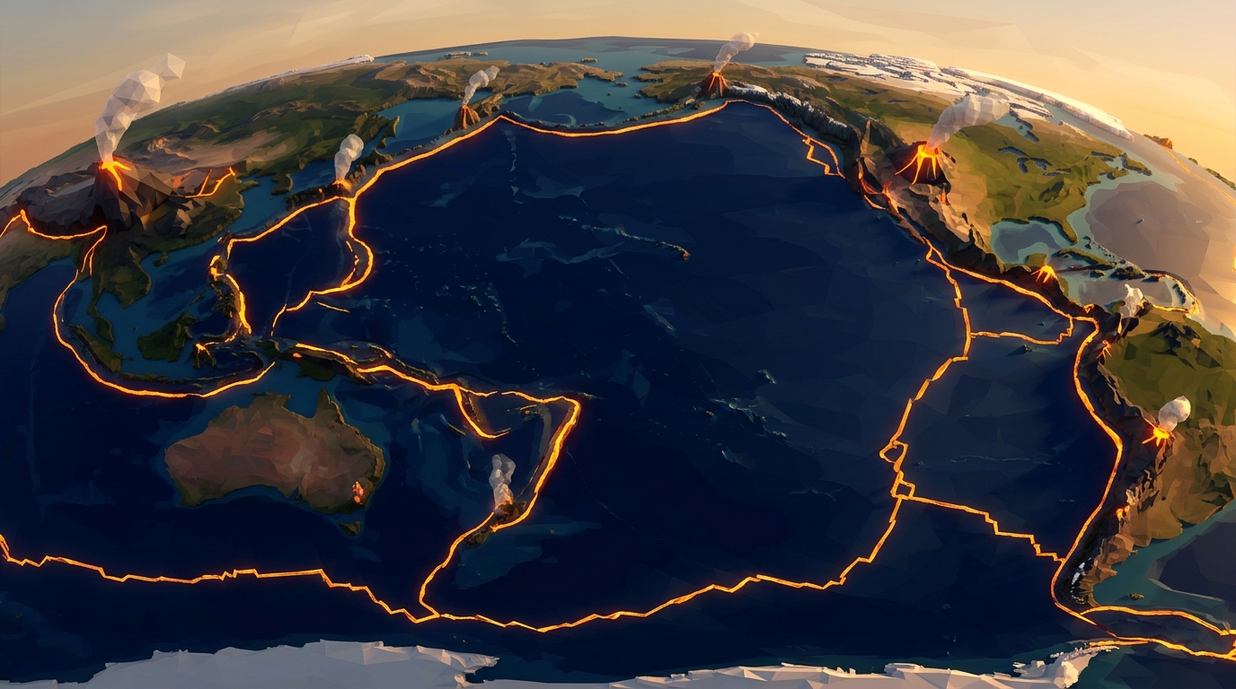
Investigates catastrophic geohazards: locked transform faults, P and S wave propagation, seismogram epicenter triangulation, megathrust tsunami water displacement, and the Pacific Ring of Fire.
Planetary Systems & Disaster Mitigation (Levels 16 to 20)
Synthesizes biology, engineering, and deep time: volcanic soil primary succession, stratospheric sulfur dimming, early warning sensor networks, supervolcano resurgent calderas, and the 1973 Eldfell lava cooling operation.
Interactive 3D Volcano & Plate Tectonics Laboratory
Control mantle heat, balance crustal buoyancy, adjust magma viscosity, and trigger real-time volcanic eruptions across 20 guided missions.
Teaching this topic tomorrow? Download the Free NGSS Student Lab Sheet (Printable PDF)
Pair your digital simulation experiments with structured hypothesis logging sheets, plate boundary mapping grids, and eruption classification charts.
The Dual-Format Framework: Pencil First, Simulate Second
One of the greatest dangers in digital STEM learning is "arcade clicking": students tapping sliders randomly, watching 3D graphics explode, and absorbing zero conceptual science. Software alone cannot force contemplative thinking.
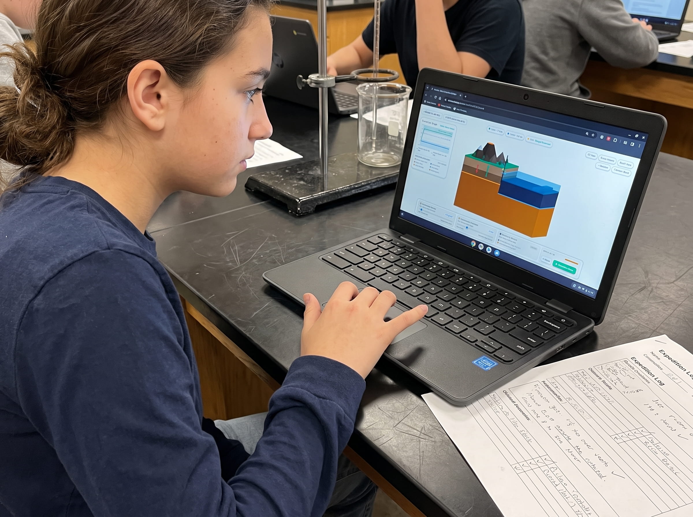
To solve this, Praxos pairs the 3D browser simulation with a physical, 24-page printed Field Geologist Expedition Logbook. The learning routine follows a strict three-step pedagogical rhythm:
Step 1 (Predict): Before touching any digital slider, the student writes down a concrete hypothesis in pencil. For example: "If I increase silica from 50% to 68%, the magma viscosity will trap gas bubbles and trigger an explosive Plinian column rather than a fluid lava flow."
Step 2 (Simulate): The student runs the 3D simulation trial, observing real-time pressure meters, flow rates, and seismic telemetry.
Step 3 (Record & Reflect): The student records the numerical outcome, sketches the resulting landform cross-section by hand, and writes a brief scientific explanation comparing their initial prediction to the simulated outcome.
This physical friction turns screen time into an intentional, active laboratory. It bridges spatial 3D visualization with tactile handwriting, resulting in dramatically higher retention and deeper conceptual mastery.
Writing predictions by hand in pencil stops impulsive tapping. When students must defend a hypothesis on paper before launching a digital trial, their engagement shifts from entertainment to genuine scientific inquiry.
Next Generation Science Standards (NGSS) Alignment
Volcano Island was engineered from the ground up to address the core middle school Earth and Space Science performance expectations in the Next Generation Science Standards (grades 3 through 8):
• MS-ESS2-1: Develop a model to describe the cycling of Earth materials and the flow of energy that drives this process. Students observe how mantle heat drives convection, melts subducted crust, and produces new rock via volcanic cooling.
• MS-ESS2-2: Construct an explanation based on evidence for how geoscience processes have changed Earth surface at varying time and spatial scales. Students compare slow continental rifting over millions of years with rapid catastrophic caldera collapses occurring in hours.
• MS-ESS2-3: Analyze and interpret data on the distribution of fossils and rocks, continental shapes, and seafloor structures to provide evidence of past plate motions. Students explore magnetic striping along mid-ocean ridges and trace stationary hotspot tracks across the Pacific plate.
Frequently Asked Questions About Volcano Simulations
Here are answers to the most common questions educators and homeschool parents ask about using 3D volcano simulations in their curriculum.
Is this volcano simulation completely free to use?
What age and grade level is Volcano Island designed for?
Will the 3D graphics run on school Chromebooks?
How long does a typical simulation lab take to complete?
Field Geologist Expedition Logbook (24-Page Printable PDF)
Pair your digital simulation experiments with structured hypothesis logging sheets, plate boundary mapping grids, and eruption classification charts.