The Island Effect on Land: How Fragmentation Traps Wildlife
In traditional ecology lessons, students calculate carrying capacity based on total land area: "This valley is 1,000 acres, so it can support 100 animals." But in the 1960s, ecologists Robert MacArthur and E.O. Wilson pioneered the Theory of Island Biogeography, demonstrating that the spatial geometry of a habitat is just as critical as its overall size.
When humans slice a continuous wilderness with a four-lane asphalt highway, a chain-link fence, or suburban development, they transform a unified continent into tiny, isolated habitat islands. Biologists call this process habitat fragmentation.
Consider what happens to a herd of foraging herbivores. Even if a hundred acres of untouched sweet grass exist directly across the road, high-speed traffic acts as an impassable death wall. Trapped on their shrinking slice of land, the isolated herd overgrazes every edible plant, degrades the local soil, and crashes into starvation.
In Level 8 of the Praxos 3D simulation ("The Great Migration"), students step into the role of a conservation civil engineer. The meadow is severed in two by a deep, rocky canyon. Students must reconnect the landscape before the stranded herd perishes.
An ecosystem is not a single container. It is a spatial network: if the nodes cannot communicate through corridors, local carrying capacity collapses.
The Bottleneck Trap: Why Narrow Bridges Fail
When students first open Level 8 and select the 3D Corridor Tool, their natural instinct is often to place the absolute minimum number of blocks: a single, narrow 1-tile pathway across the canyon.
On paper, a 1-tile bridge connects the two sides. But in spatial systems dynamics, an ultra-narrow conduit introduces a lethal phenomenon: the predatory choke point.
In Level 8, low-poly gray wolves patrol the terrain. When rabbits funnel through a single-file bridge, their movement is constrained into a predictable linear bottleneck. Wolves congregate at the bridge exit and ambush crossing herbivores one by one. Our telemetry data reveals that bridges built only 1 to 2 tiles wide suffer a 100% predation mortality rate, starving the herd and failing the level.
To succeed, students must think like modern wildlife crossing designers: building broad corridors (3 to 4 blocks wide) with sightlines and vegetative cover that allow distributed herd crossings and prevent predator ambushes.
| Corridor Design | Width in Grid Blocks | Herbivore Transit Success | Ecological Outcome |
|---|---|---|---|
| BLOCKEDNo Corridor (Disconnected) | 0 Blocks (Default Start) | 0% Crossing Rate | Stranded herd exhausts barren zone; 100% starvation by Day 20 |
| LETHAL BOTTLENECKNarrow Choke Point | 1 to 2 Blocks Wide | 15% to 25% Crossing Rate | Predator ambush bottleneck; wolves trap and kill herbivores at bridge exit |
| BALANCED CORRIDORBroad Wildlife Overpass | 3 to 4 Blocks Wide | 85% to 95% Crossing Rate | Distributed crossing; herd reaches lush pasture safely; both species survive 60 days |
The Mechanics of Level 08: Engineering the Crossing Across 60 Days
Level 08 splits the meadow map with a 2-cell deep canyon. The simulation starts with an acute ecological crisis:
The Right Bank: Barren dirt with 0% grass coverage, home to 15 to 25 hungry rabbits and 2 wolves.
The Left Bank: An untouched paradise with 100% dense green grass coverage and zero animals.
The Empty Chasm: The chasm begins with 0 bridge blocks. If a student hits Play without building, all rabbits starve within 20 days.
The Win Condition: Keep both species alive (Rabbits >= 1 and Wolves >= 1) and maintain healthy pasture coverage across 60 days.
Here is the verified scientific strategy to clear Level 8 with a 3-star rating:
Step 1: Construct a Broad Wildlife Bridge (3 to 4 Blocks Wide)
Select the 3D Wildlife Corridor Tool from the bottom dock. Click on the canyon tiles to lay soil blocks, bridging the chasm with a generous 3 to 4 tile-wide overpass. Avoid creating narrow 1-tile bottlenecks.
Step 2: Calibrate Starting Population Stocks (20-28 Rabbits, 2-3 Wolves)
Tune your starting herd to 20-28 rabbits and 2-3 wolves. Having enough initial foragers ensures that a strong vanguard crosses immediately into the green meadow to establish a breeding nucleus.
Step 3: Monitor Dispersal & Trophic Balance (Day 16 to Day 60)
Once rabbits settle on the green bank, wolves follow across the overpass. Because the bridge is wide, wolves do not camp at a single chokepoint. Both banks reach a healthy equilibrium, securing a decisive victory through Day 60.
Play Level 1 free in your browser to master ecosystem basics, or advance to Level 8 to engineer 3D wildlife overpasses and eliminate predatory choke points.
Play Level 1 Free in BrowserReal-World Conservation: The Banff National Park Overpasses
Is building green bridges across human obstacles actually effective in real conservation biology? The world's gold standard is located in Banff National Park in Alberta, Canada.
In the 1980s, the four-lane Trans-Canada Highway sliced directly through the heart of the Canadian Rockies, killing hundreds of elk, deer, moose, grizzly bears, and wolves every year in violent vehicular collisions and severing wildlife populations into isolated fragments.
Parks Canada responded with a groundbreaking engineering feat: constructing 44 wildlife crossings (including 6 massive, 60-meter-wide vegetated overpasses and 38 underpasses), reinforced by roadside fencing.
The results revolutionized wildlife ecology: wildlife collisions plummeted by more than 80% (and by over 96% for deer and elk). Camera traps recorded more than 200,000 safe wildlife crossings by 11 large mammal species. Crucially, genetic testing confirmed that grizzly bear and wolf populations on both sides of the highway were once again interbreeding, preventing inbreeding depression.
In Level 8, students experience the exact same spatial engineering challenges that Parks Canada tackled: discovering that true conservation requires designing pathways that respect the natural psychology of both predator and prey.
Over 200,000 recorded wildlife crossings and an 80% drop in highway collisions proved that wide vegetated bridges restore severed continental ecosystems.
Hands-On Science Journal: Multi-Species Overpass Blueprint
Bring spatial landscape ecology into the physical world with these three tactile science notebook prompts:
1. The Architectural Bridge Blueprint: Have your student draw an aerial (top-down) blueprint of a wildlife overpass over a highway. Include: wide entrance funnels, native soil and grass coverings, dense shrub borders on the edges to block headlight glare and highway noise, and open sightlines in the center so prey can detect approaching predators.
2. The Choke Point Calculation: Draw two scenarios: Scenario A with a 10-meter bridge, and Scenario B with a 60-meter bridge. Draw three wolves and ten rabbits in each. Write an explanation of why increasing bridge width lowers predator hunting efficiency and prevents ambush traps.
3. The Local Neighborhood Fragmentation Map: Look at a map of your town or city. Identify three human barriers (highways, railways, concrete storm drains, or shopping malls) that fragment local animal habitats. Discuss what species live nearby (squirrels, turtles, deer, foxes) and brainstorm where a greenway corridor would do the most good.
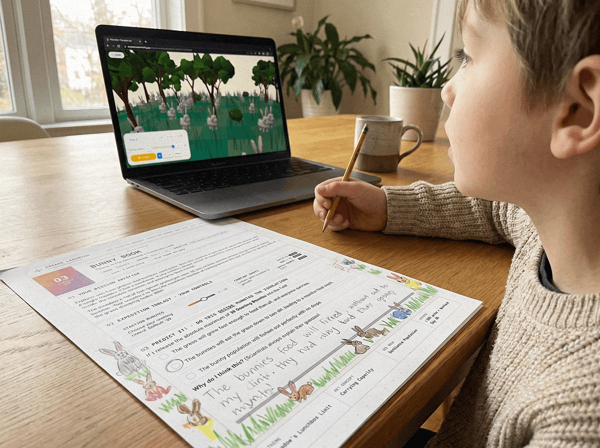
Download the free 24-page PDF journal to sketch wildlife bridge architectural blueprints, map local habitat fragmentation, and log simulation data.
Download Level 8 Journal (PDF)Frequently Asked Questions: Habitat Fragmentation & Corridors
Common questions from teachers, parents, and homeschoolers regarding spatial ecology and wildlife bridges:
What is habitat fragmentation?
Why do narrow wildlife bridges fail in the simulation?
How do wildlife corridors protect genetic health?
Can students play Praxos Level 8 in the browser for free?
Level 8 Mission Log & Wildlife Overpass Blueprint (PDF)
A printable 24-page Expedition Science Journal featuring wildlife crossing engineering blueprints, Banff National Park case studies, and spatial network flow charts.