Beyond the Crater: Earth's Giant Sunken Cauldrons
When middle school students picture an active volcano, they almost always imagine a steep, cone-shaped mountain with a small, circular bowl at the summit blasting out steam and rocks. In geology, that summit bowl is a crater. But the most powerful, landscape-altering volcanic events on planet Earth do not leave mountains behind: they leave gigantic, gaping basins that stretch for miles across the horizon.
These colossal depressions are calderas, derived from the Spanish word for "cauldron." Calderas are so vast that when you stand on their rim, you often cannot see the opposing wall. Yellowstone National Park is situated inside a caldera measuring 72 kilometers by 45 kilometers (45 by 28 miles). Oregon's famous Crater Lake is a caldera that swallowed an entire 3,700-meter (12,000-foot) stratovolcano called Mount Mazama.
To help students grasp the structural physics of how a caldera forms, I use the analogy of an underground inflatable air mattress: imagine a heavy concrete floor supported by a gigantic, high-pressure inflatable mattress underneath. If someone slices open the mattress valves, the compressed air rushes out in a violent blast. Deprived of the upward pressure supporting it, that heavy concrete ceiling cannot hover in mid-air: it fractures and caves directly downward into the newly empty space. In planetary geology, the air is gas-charged rhyolitic magma, the concrete floor is kilometers of solid continental crust, and the sunken basin is a volcanic caldera.
Caldera vs. Crater: The Critical Geological Difference
Textbooks often conflate craters and calderas, creating lasting confusion for middle school and high school science students. The distinction rests on structural mechanics, diameter, and the direction of rock movement:
A Volcanic Crater is an excavation feature formed by outward explosive venting. As gas-rich magma ascends through a volcanic conduit, explosive decompression pulverizes wall rocks and ejects debris into the air. Craters are relatively small (almost always less than 1 to 2 kilometers in diameter) and are positioned directly above the active vent at the top or flank of a volcanic cone.
A Volcanic Caldera is a collapse structure formed by downward structural failure. Calderas are massive (ranging from 2 to over 80 kilometers across). They are not blasted out of the crust by dynamite-like explosions; rather, they form when thousands of cubic kilometers of magma are evacuated so quickly that the crust above loses its hydraulic foundation and drops into the emptied chamber.
The Four Stages of Caldera Formation and Resurgence
Caldera collapse is not a random cave-in. It is the predictable mechanical culmination of a four-stage volcanic cycle governed by fluid pressure, rock elasticity, and gravity:
Stage 1: Magma Reservoir Inflation and Crustal Doming. Over hundreds of thousands of years, buoyant, highly viscous, silica-rich magma (dacite or rhyolite) ascends from the mantle and collects in the shallow upper crust, typically 3 to 8 kilometers beneath the surface. As fresh magma continues to inflate the reservoir, hydrostatic pressure mounts. The overlying crust bends upward like a slowly inflating balloon, creating a broad topographic dome surrounded by concentric fracture networks.
Stage 2: Ring Fracture Rupture and Cataclysmic Plinian Eruptions. As magma pressure reaches a critical threshold, the tensile strength of the crust is exceeded. Instead of venting through a single central pipe, the crust cracks open along a circular perimeter of steep faults known as ring fractures. Dissolved water and carbon dioxide dissolved within the magma violently decompress, turning the magma into an explosive froth of pumice and ash. Enormous Plinian eruption columns blast into the stratosphere, while catastrophic pyroclastic density currents sweep across thousands of square kilometers.
Stage 3: Piston-Like Roof Collapse. Because magma erupts through the ring fractures at rates exceeding tens of thousands of tons per second, the magma chamber evacuates far faster than new magma can arrive from below. Deprived of the fluid pressure that propped it up, the massive cylindrical plug of crust bounded by the ring faults drops downward like a piston. This collapse drops the surface by hundreds or even thousands of meters, forming the steep-walled caldera basin.
Stage 4: Resurgent Doming, Hydrothermal Vents, and Caldera Lakes. Once the explosive eruption subsides, the caldera floor undergoes long-term geological transformation. Residual magma remaining in the deep roots of the reservoir begins to repressurize, flexing the center of the caldera floor upward into a structural feature called a resurgent dome (such as Wizard Island in Crater Lake or the Mallard Lake dome in Yellowstone). Rain and melting snow fill the impermeable basin to form deep, pristine caldera lakes, while subterranean heat fuels boiling mud pots, fumaroles, and geysers.
Comparative Analysis: Earth's Most Famous Volcanic Calderas
The table below summarizes the dimensions, erupted volumes, and geological settings of Earth's most prominent caldera systems:
| Caldera Name | Geographic Location | Caldera Dimensions | Erupted Volume (DRE) | Date / Era of Collapse | Tectonic Setting & Features |
|---|---|---|---|---|---|
| Flagship Continental CalderaYellowstone Caldera | Wyoming / Montana, USA | 72 km x 45 km (45 x 28 mi) | ~1,000 km³ (Lava Creek Tuff) | 631,000 years ago | Continental Hotspot; multiple resurgent domes & 10,000+ geothermal features |
| Lake Toba Caldera | North Sumatra, Indonesia | 100 km x 30 km (62 x 19 mi) | ~2,800 km³ (Youngest Toba Tuff) | 74,000 years ago | Subduction Zone Supervolcano; largest Quaternary caldera on Earth, giant resurgent island (Samosir) |
| Crater Lake (Mount Mazama) | Oregon, USA | 8 km x 10 km (5 x 6 mi) | ~50 km³ | ~7,700 years ago (~5700 BCE) | Cascade Volcanic Arc; 594 m deep caldera lake, Wizard Island cinder cone / resurgent vent |
| Santorini (Thera) Caldera | Cyclades, Greece | 12 km x 7 km (7.5 x 4.3 mi) | ~60 km³ (Minoan Eruption) | ~1610 BCE | Hellenic Subduction Arc; sea-filled caldera basin, Nea Kameni active post-collapse dacite domes |
| Krakatoa Caldera | Sunda Strait, Indonesia | 7 km x 4 km (4.3 x 2.5 mi) | ~25 km³ | 1883 CE | Indo-Australian Subduction Zone; catastrophic tsunami-generating collapse, Anak Krakatau post-caldera cone |
| Long Valley Caldera | California, USA | 32 km x 17 km (20 x 10 mi) | ~650 km³ (Bishop Tuff) | 767,000 years ago | Basin & Range Extension; central resurgent dome, Casa Diablo geothermal field |
Simulate Caldera Collapse in Interactive 3D
Take manual command of subterranean magma chamber volume, volatile gas overpressure, and crustal roof thickness in real time. Evacuate the magma reservoir to trigger ring fault fractures, watch the crustal ceiling collapse inward, and observe resurgent dome inflation.
Teaching this topic tomorrow? Download the Free NGSS Student Lab Sheet (Printable PDF)
Equip your middle school earth science students with printable caldera cross-section diagrams, collapse volume calculation tables, and NGSS MS-ESS2-2 inquiry lab pages.
Hands-On Classroom Inquiry: 4-Step Caldera Modeling Protocol
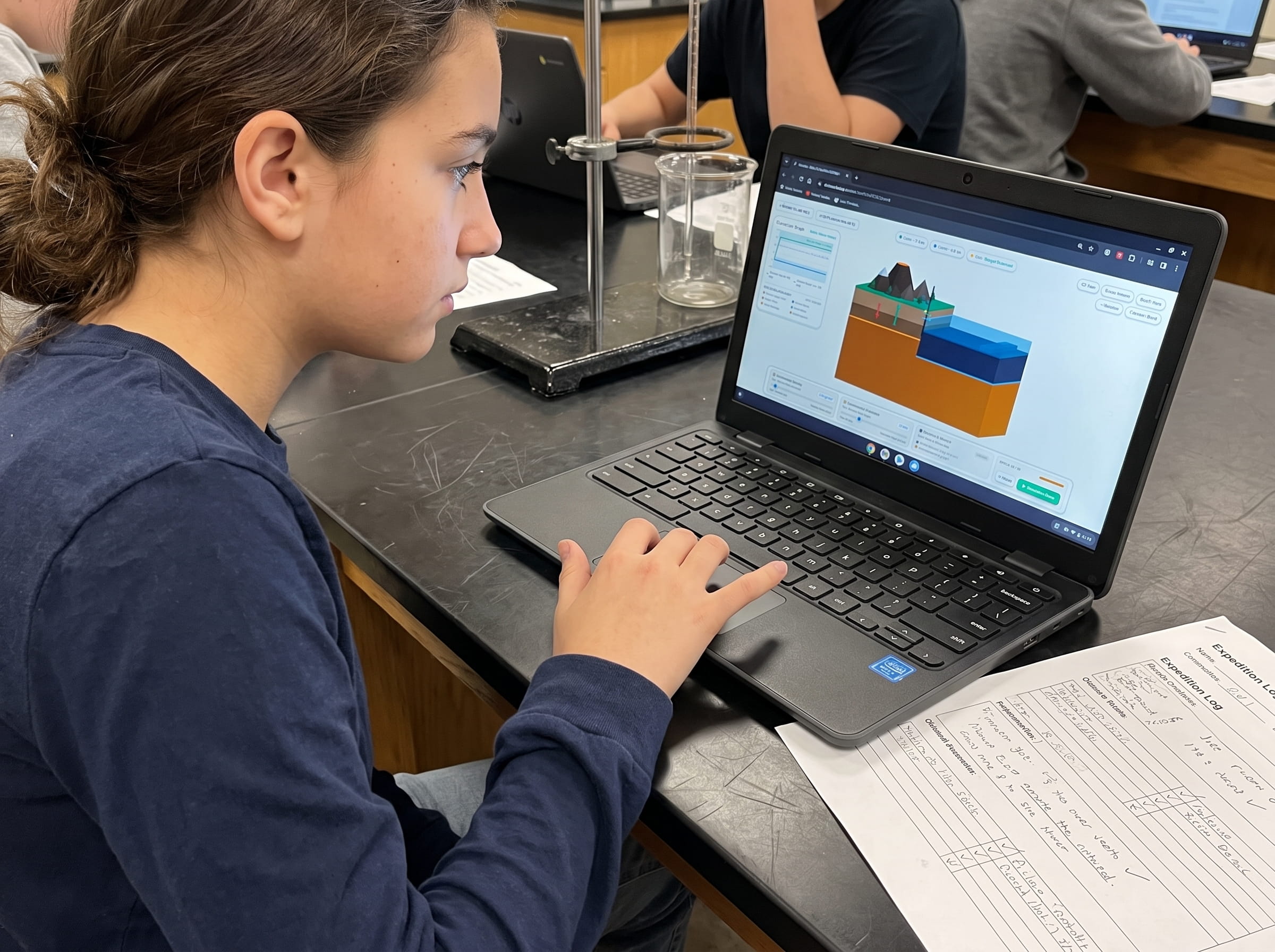
When teaching NGSS MS-ESS2-2 and MS-ESS2-3 (Geoscience Processes & Plate Motions), students frequently struggle to visualize how removing material from below causes structural failure above. In Volcano Island Level 9, I engineered direct parameter controls allowing students to manipulate subterranean magma chambers and observe collapse dynamics in real-time 3D:
Formulate Structural Support Hypotheses
Have students analyze cross-sectional profiles of pre-collapse stratovolcanoes versus caldera basins. Students formulate hypotheses explaining why a solid rock mountain cannot remain standing once its underlying magma chamber is drained.
Manipulate Magma Chamber Evacuation in 3D
Launch Volcano Island Level 9 and set magma chamber capacity to 50 cubic kilometers. Trigger an explosive eruption and watch magma reservoir volume decrease. Observe the exact moment when upward fluid pressure drops below the gravitational weight of the overlying rock roof.
Map Ring Fractures and Measure Piston Subsidence Depth
Have students track the formation of vertical ring faults surrounding the caldera perimeter. Measure the total vertical drop of the central piston block and calculate the final diameter of the sunken basin.
Model Resurgent Doming and Caldera Lake Filling
Introduce fresh magma influx into the deep roots of the drained chamber. Watch the caldera floor warp upward to produce a resurgent dome. Add simulated precipitation to model how Crater Lake accumulated over 700 years of rainwater without external river inlets.
Frequently Asked Questions About Calderas and Supervolcanoes
Explore common educator and student questions regarding caldera collapse, supervolcano hazards, and geothermal activity:
What is the main difference between a crater and a caldera?
Could the Yellowstone supervolcano caldera erupt tomorrow and destroy North America?
What is a resurgent dome and why does it form inside a caldera?
Why do caldera-forming eruptions tend to be highly explosive rather than gentle lava flows?
Related Earth Science Guides and Interactive Laboratories
Continue expanding your middle school earth science and plate tectonics curriculum with our companion interactive guides:
Explore why magma thickness dictates eruption explosiveness in our magma silica viscosity guide.
Learn how tectonic plates collide and subduct in our convergent plate boundaries guide.
Discover Earth's deepest subduction chasms in our ocean trenches and subduction zones guide.
Investigate how rocks melt, cool, and transform in our interactive rock cycle guide.
Explore the heat engine driving plate motions in our mantle convection currents guide.
See how tectonic plates slide past each other in our transform fault boundaries guide.
Explore our complete 20-level hands-on Earth science simulation curriculum options.
Download the Free 24-Page Field Geologist Logbook
Equip your middle school earth science students with printable caldera cross-section diagrams, collapse volume calculation tables, and NGSS MS-ESS2-2 inquiry lab pages.